Between 1500-1900, the Arenal Volcano remained silent and was considered by many to be extinct. In fact, the local farmers and ranchers who worked the land along its base referred to it as a mountain: Cerro Arenal (Arenal Mountain).

However, on Monday, July 29, 1968 at 7:30 AM, the Arenal Volcano suddenly and violently erupted. The eruptions continued unabated for several days, burying over 15 square kilometers with rocks, lava and ash. When it was finally over, the eruptions had killed 87 people and buried 3 small villages – Tabacón, Pueblo Nuevo and San Luís – and affected more than 232 square kilometers of land. Crops were spoiled, property was ruined, and livestock was killed. It was a difficult time for the people of Arenal.
At the height of its ferocious activity, the volcano flung giant rocks – some weighing several tons – more than a kilometer away at a rate of 600 meters per second. These explosions would go on to form three new active craters.


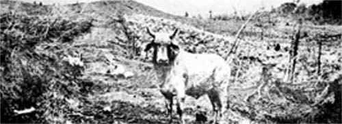
Photo: The desolated village of Arenal, with a main street paved by lava, was covered a few years later when Costa Rica’s largest hydroelectric project, the Lake Arenal Dam, created an extensive water reservoir.
Between 1968 and 2010, the Arenal Volcano was extremely active – it spewed hot rocks, smoke, ash, and lava from its top almost every day. None of the explosions, however, compared to that of 1968. Since then, the locals have taken caution in building their settlements and farms too close to the volcano. At the present, all towns, hotels and trails are set at a safe distance from Arenal.
Although the volcano took the lives of many men and women, it has given back to the community by becoming one of Costa Rica's most visited natural attractions. While agriculture is still important to the region, tourism has surpassed this to become the main source of income for the area’s people.
Most recent Arenal Volcano Photos! | Arenal Eruption May 22, 2005 Photos | Arenal Eruption May 15, 2005 Photos | September 5th. 2003 Eruption
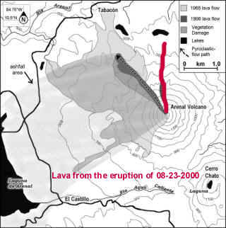
Map of the Arenal Volcano lava flow, by the Smithsonian Institute.

The red indicates the direction of the lava flow in 2000 & a major eruption.
Arenal map and lava flow update | Regional Map to Arenal | Costa Rica map | Satellite photo 
